Florida Memory is administered by the Florida Department of State, Division of Library and Information Services, Bureau of Archives and Records Management. The digitized records on Florida Memory come from the collections of the State Archives of Florida and the special collections of the State Library of Florida.

State Archives of Florida
- ArchivesFlorida.com
- State Archives Online Catalog
- ArchivesFlorida.com
- ArchivesFlorida.com
State Library of Florida
Related Sites
29 items found
| Identifier | Title | Type | Subject | Thumbnail | |
|---|---|---|---|---|---|
| fmc0067 | Amelia Island Plan and Natutical Charts, 1770 | Amelia Island (Fla.)--Maps--Early works to 1800. Saint Marys River (Ga. and Fla.)--Maps--Early works to 1800. Nassau River--Maps--Early works to 1800. | /FMP/maps/thumbnails/fmc0067.jpg | ||
| fmc0070 | Bohemia and Pensacola Bay Nautical Chart, 1889 | Nautical charts--Florida--Pensacola Bay. Coasts--Florida--Bathymetric maps. Bays--Florida--Bathymetric maps. Pensacola Bay (Fla.)--Maps, Bathymetric. | /FMP/maps/thumbnails/fmc0070.jpg | ||
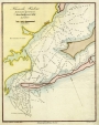
| fmc0060 | Choctawhatchee Inlet to Pensacola Entrance Nautical Chart, 1881 | Nautical charts--Florida--Pensacola Bay. Coasts--Florida--Maps, Bathymetric. Bays--Florida--Maps, Bathymetric. Pensacola Bay (Fla.)--Maps, Bathymetric. Escambia Bay (Fla.)--Maps, Bathymetric. East Bay (Fla.)--Maps, Bathymetric. Choctawhatchee Bay--Maps, Bathymetric. | /FMP/maps/thumbnails/fmc0060.jpg | ||
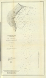
| fmc0065 | Entrance to St. Johns River Nautical Chart, 1853 | Rivers--Florida--Maps, Bathymetric. Nautical charts--Florida--Saint Johns River--Maps, Bathymetric. Saint Johns River--Maps, Bathymetric. | /FMP/maps/thumbnails/fmc0065.jpg | ||
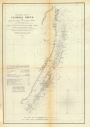
| fmc0066 | Florida Reefs Nautical Charts, Key Biscayne to Pickles Reef, 1856 | Coral reefs and islands--Florida--Maps, Bathymetric. Nautical charts--Florida--Florida Keys. Florida --Maps, Bathymetric. | /FMP/maps/thumbnails/fmc0066.jpg | ||
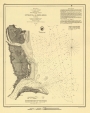
| fmc0058 | Key West Harbor Nautical Chart, 1852 | Harbors--Florida--Key West--Bathymetric maps. Nautical charts--Florida--Key West. Key West (Fla.)--Bathymetric maps. | /FMP/maps/thumbnails/fmc0058.jpg | ||
| fmc0076a | Map of Pensacola Harbor, 1854 | Nautical charts--Florida--Pensacola. Harbors--Florida--Pensacola--Bathymetric maps. Pensacola Bay (Fla.)--Bathymetric maps. | /FMP/maps/thumbnails/fmc0076a.jpg | ||
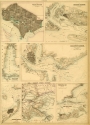
| fmc0081a | Map of Southern Ports & Harbours with Key West and Pensacola, 1862 | Harbors--Southern States--Maps. | /FMP/maps/thumbnails/fmc0081a.jpg | ||
| fmc0084 | Map of St. Augustine, Florida 1764 | Harbors--Florida--Saint Augustine--Maps--To 1800. | /FMP/maps/thumbnails/fmc0084.jpg | ||
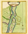
| fmc0085 | Map of the St. Johns River, 1791 | Rivers--Florida--Maps--To 1800. Saint Johns River--Maps--To 1800. | /FMP/maps/thumbnails/fmc0085.jpg |